2014 is shaping up to be an “average” year for the Colorado River watershed, which provides water to 7 western states. That’s not good news, however, for states like California and Nevada which are already experiencing drought conditions.
Kevin Werner is a hydrologist at the National Oceanic and Atmospheric Administration’s Colorado Basin River Forecast Center in Utah. His office is predicting below average inflow to Utah and Arizona’s Lake Powell. But Colorado has a small bright spot.
“The part of the basin that generates the most water is in the state of Colorado in the rocky mountains and that’s the part of the basin that’s been doing the best,” said Werner.
“Especially in the northern part of the state in Yampa River Basin, the steamboat springs area has actually seen precipitation totals above normal, that’s the only part of the basin where that’s been the case.”
2012 and 2013 were the two driest consecutive years since the filling of Lake Powell, so Werner says an average year of precipitation will only help slightly.
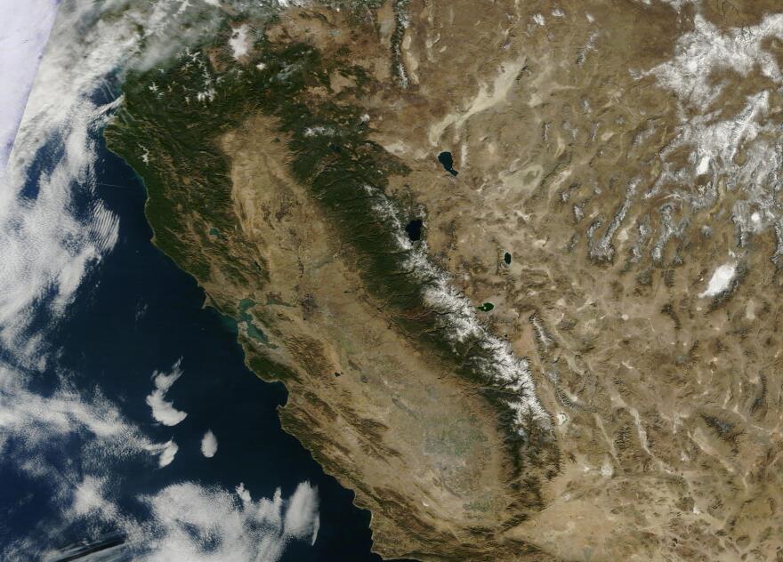
California is looking startlingly dry in the view from space. http://t.co/s7wbI7wmsP pic.twitter.com/5LtWrTeZof
— NASA Earth (@NASAEarth) January 23, 2014
The pain is also being felt in Lake Mead, which is fed by Lake Powell. According to a New York Times article, the time period when most of the west’s water was divvied up in was abnormal.
Studies now show that the 20th century was one of the three wettest of the last 13 centuries in the Colorado basin. On average, the Colorado’s flow over that period was actually 15 percent lower than in the 1900s. And most experts agree that the basin will get even drier: A brace of global-warming studies concludes that rising temperatures will reduce the Colorado’s average flow after 2050 by five to 35 percent, even if rainfall remains the same — and most of those studies predict that rains will diminish. Already, the drought is upending many of the assumptions on which water barons relied when they tamed the Colorado in the 1900s.
Werner says late season storms are possible in western states, but they would only help areas where the snow falls and not the basin as a whole.
See The Evidence: 2014 is the top pic, just one year ago in the bottom pic of the same section of California.


