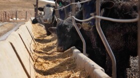
There are thousands of concentrated animal feeding operations, or CAFOs, around the United States, but no one knows the exact number.
Two Stanford University professors published research this week in the journal Nature Sustainability, saying there’s an easy way to count CAFOs: Teach a computer to do it for them.
Environmentalists have long been concerned about the rise of CAFOs, which can produce massive amounts of meat and waste. But CAFOs are a necessity for farmers who want to produce cheap meat.
In 2007, environmental groups went after the Iowa Department of Natural Resources, alleging it wasn’t doing its job regulating animal confinements and asking the federal government to take over. To appease the U.S. Environmental Protection Agency and maintain oversight, Iowa’s DNR agreed to increase state inspections and find out just how many CAFOs there were in the state.
After more than three years of searching through satellite images, the department said it found more than 5,000 animal confinement facilities beyond what it previously knew about. More than a thousand of those may have needed state regulatory oversight.
Finding CAFOs is the first step in establishing environmental oversight, according to Stanford’s Daniel Ho, who worked with PhD student r on the research.
“We actually make this process of identifying CAFOs significantly easier by using some of the rapid advances in machine learning that have occurred over the past five years,” he said.
Ho said they used satellite images from the U.S. Department of Agriculture to map CAFOs in North Carolina, ultimately finding 589 more poultry CAFOs (15% more) than were mapped in previous manual surveys.
He said this doesn’t replace the need for ground monitoring, but will help people who monitor the environment know where to look for potential contamination. Ho pointed to Hurricane Florence, saying environmental groups weren’t sure where manure pits could have been breached and leached into waterways during the storm.
“There was a real concern about the fact that poultry facilities in North Carolina were unpermitted, so it was really hard to even track where folks should be looking to understand the impact of Hurricane Florence,” he said.
This kind of machine learning could be applied in other states across the U.S., Ho said, but CAFO types and sizes differ from state to state so the computer program would have to be reworked.
Smithfield Foods, a major buyer of meat from North Carolina CAFOs, didn’t immediately return a request for comment.
Follow Madelyn on Twitter @MadelynBeck8
Copyright 2020 Harvest Public Media. To see more, visit . 9(MDAxNDQ2NDAxMDEyNzU2NzM2ODA3ZGI1ZA001))


